Introduction
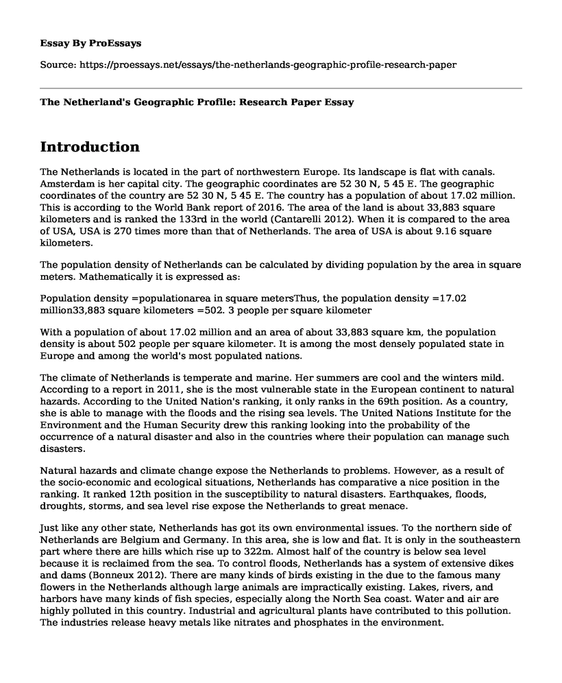
The Netherlands is located in the part of northwestern Europe. Its landscape is flat with canals. Amsterdam is her capital city. The geographic coordinates are 52 30 N, 5 45 E. The geographic coordinates of the country are 52 30 N, 5 45 E. The country has a population of about 17.02 million. This is according to the World Bank report of 2016. The area of the land is about 33,883 square kilometers and is ranked the 133rd in the world (Cantarelli 2012). When it is compared to the area of USA, USA is 270 times more than that of Netherlands. The area of USA is about 9.16 square kilometers.

The population density of Netherlands can be calculated by dividing population by the area in square meters. Mathematically it is expressed as:
Population density =populationarea in square metersThus, the population density =17.02 million33,883 square kilometers =502. 3 people per square kilometer
With a population of about 17.02 million and an area of about 33,883 square km, the population density is about 502 people per square kilometer. It is among the most densely populated state in Europe and among the world's most populated nations.
The climate of Netherlands is temperate and marine. Her summers are cool and the winters mild. According to a report in 2011, she is the most vulnerable state in the European continent to natural hazards. According to the United Nation's ranking, it only ranks in the 69th position. As a country, she is able to manage with the floods and the rising sea levels. The United Nations Institute for the Environment and the Human Security drew this ranking looking into the probability of the occurrence of a natural disaster and also in the countries where their population can manage such disasters.
Natural hazards and climate change expose the Netherlands to problems. However, as a result of the socio-economic and ecological situations, Netherlands has comparative a nice position in the ranking. It ranked 12th position in the susceptibility to natural disasters. Earthquakes, floods, droughts, storms, and sea level rise expose the Netherlands to great menace.
Just like any other state, Netherlands has got its own environmental issues. To the northern side of Netherlands are Belgium and Germany. In this area, she is low and flat. It is only in the southeastern part where there are hills which rise up to 322m. Almost half of the country is below sea level because it is reclaimed from the sea. To control floods, Netherlands has a system of extensive dikes and dams (Bonneux 2012). There are many kinds of birds existing in the due to the famous many flowers in the Netherlands although large animals are impractically existing. Lakes, rivers, and harbors have many kinds of fish species, especially along the North Sea coast. Water and air are highly polluted in this country. Industrial and agricultural plants have contributed to this pollution. The industries release heavy metals like nitrates and phosphates in the environment.
The electricity consumed in Netherlands is generated from gas and coal. There is, however, increasing adoption of the renewable sources of energy, for example, wind power. Water used by the public for drinking purpose is safe one of the best in Europe such that bottled one is of no need. In its capital city, water has little calcium thus good water-using machines.
There is the use of curbside recycling throughout the Netherlands, with many recycling bins placed strategically everywhere. Transport means is mostly by use of trains or buses. Buses mostly run on hydrogen thus emitting no harmful gases. There is also a subway system. To get to Amsterdam, the most popular way is to use a canal system. Use of bikes is also a way to move around the country.
There are many vegetarian restaurants in Amsterdam and other major cities. Organic products are also available in these restaurants. Variety of beer brands like dark stouts are sold. The Marine Stewardship Council label is used to indicate that seafood sold are well managed.
There are various parks in the Netherlands. An example is the Schiermonnikoog National Park in the Northern region. The national park is known for salty marshes and tidal flats where many species of birds are found. Others are Oosterschelde National Park, De Hoge Veluwe National Park, and the Vondel Park.
Figure 1: Map of Netherlands
Netherland falls into three natural divisions of topography. They are the dunes, the low-lying land that was reclaimed from the sea and the county's eastern part that is higher. The low land is protected by dikes.
Figure 2: Topographic Map
As stated above, Netherlands' climate is temperate maritime. This is influenced by the Atlantic Ocean and the North Sea has influenced her climate. Her winters are moderate with cool summers. The country's daytime temperatures range from 2-6 and 17-20 degrees Celsius during winter and summer season respectively.
Figure 3: Climate Map
In Netherlands, July is the warmest month of the year (Lehikoinen 2016). The range of the temperatures is between 13 and about 22 degrees Celsius during the night and midday respectively. On the other hand, January is ranked as the coldest month with an average of 2.5 degrees Celsius on most days.
Figure 4: the precipitation map
Figure 5: The precipitation graph
Natural hazards and climate change expose the Netherlands to problems. However, as a result of the socio-economic and ecological situations, Netherlands has comparative a nice position in the ranking. It ranked 12th position in the susceptibility to natural disasters. Earthquakes, floods, droughts, storms, and sea level rise expose the Netherlands to great menace
Figure 6: Flood Map
There are more than 24,500 species of animals existing in the Netherlands not forgetting the over 10,000 plant types. This is according to the Environmental Data Compendium.
Figure 7: Biomes Map
There is a coastal dune in the northern sea. The sands, marine in origin are deposited by onshore winds. To the east, there are marine clays covering the northern and western parts of the Country. In the central region, the main soil type is river clay (Grunwald 2016). There are also sand soils in the east and south regions. The clay soils are rich and good for crop production.
Figure 8: Soil Map
References
Bonneux, L., Van Der Gaag, N., & Bijwaart, G. (2012). Demographic epidemiologic projections of long-term care needs in selected European countries: Germany, Spain, the Netherlands and Poland.
Cantarelli, C. C., Flyvbjerg, B., & Buhl, S. L. (2012). Geographical variation in project cost performance: the Netherlands versus worldwide. Journal of Transport Geography, 24, 324-331.
Grunwald, S. (Ed.). (2016). Environmental soil-landscape modeling: Geographic information technologies and pedometrics. CRC Press.
Lehikoinen, A., Jaatinen, K., Vahatalo, A. V., Clausen, P., Crowe, O., Deceuninck, B., ... & Nilsson, L. (2013). Rapid climate driven shifts in wintering distributions of three common waterbird species. Global Change Biology, 19(7), 2071-2081.
Cite this page
The Netherland's Geographic Profile: Research Paper. (2022, Mar 31). Retrieved from https://proessays.net/essays/the-netherlands-geographic-profile-research-paper

so we do not vouch for their quality

If you are the original author of this essay and no longer wish to have it published on the ProEssays website, please click below to request its removal:
- Some Questions on Physics
- The Mystery of Black Holes Essay
- Haber Process Essay Example
- Discovering the Universe: Bing Bang Theory, String Theory Paper Example
- Life Beyond Earth Essay Example
- Challenges and Methods of Archeology: Essay Sample
- Unveiling the Chemistry Connection: Physical Attraction & Social Interactions - Essay Sample


