Introduction
Hollister is in San Benito County found in Central California. It is located between San Juan Bautista and Gilroy in the northeast of Salinas near the San Luis Reservoir along Highway 156 (Schoenherr, 2017). Hollister lies at the south end of Santa Clara Valley in a lowland basin called the Hollister Valley. There are coastal mountains that surround the valley that include the Quien Sabe Range in the east, Santa Cruz Mountains in the Northwest, and the Gavilan Range to the Southwest. The San Benito River provides the terraces upon which the city was built. The Hollister Hills is situated in the west and south of Hollister. They are the foothills to the Southwest Gavilan Range.

There are frequent earthquakes in Hollister more than anywhere else due to the Calaveras fault on which the city stands. The Calaveras Fault is a strand from the San Andreas Fault that crosses the Hollister Hills from the southern side of San Juan Valley (Keller & Morgan, 2016). There is the Sargent Fault zone that shapes along the Flint Hills. Together with the San Andreas Fault Zone and the Calaveras, they intersect at the Pinnacles National Park and the San Benito River Valley southward. Hollister has a landscape that is shaped by these Faults (Jiang & Lee, 2017). The Faults cause the San Juan Valley and Hollister city to sink as they push the mountains and the hills.
Hollister has a long history that dates back to 1868 and is an interesting geology field trip destination in the United States (Schoenherr, 2017). It is a city that prides itself on being the capital of earthquakes, which is a trait that it shares with Parkfield and Coalinga. The city of Hollister is built on the Calaveras Fault which is a highly geologically active strand of the San Andreas Fault. Vista Hill is a good first stop for a field trip around the city. The next stop should be Dunne Park between 6th and 7th street that has an active seismic creeping trace of the Calaveras Fault (Jachens,2017). There are many other places to visit when in Hollister city where one can see and learn of the region's geological history and geological landmarks. The geological field trip destinations include the Fremont Peak State Park, San Juan Bautista, Pinnacles National Park, and the San Andreas Fault in Cienega Valley (Jiang & Lee, 2017). They are some of the geological sites in the city of Hollister that anyone interested in the area can look up.
Hollister was once a region inhabited by the Amah Mutsun Ohlone Indians. That was before the establishment of the San Juan Bautista Mission in 1797 (Keller & Morgan, 2016). The Indians lived in small communities scattered along the terraces of the Pajaro and San Benito rivers. The arrival of the Spanish/Mexican missionaries that established San Juan Bautista resulted in the subjugation of the indigenous population into service. The land was divided into homesteads and ranchos by the early 1800s. Therefore, the settlers came in and changed the way of life of the locals by establishing a missionary, engaging them in service, and dividing their areas of residence. Nonetheless, California separated from Spanish control by 1834, and the missions were secularized (Schoenherr, 2017).
In 1847, the US Army, led by John C. Fremont, clashed with the Mexican army that led the region to be declared as s Bear Flag Republic. There was an upsurge of non-Spanish speaking people in the region during the California Gold Rush of 1849 (Schoenherr, 2017). The region then became the state of California in 1850 as a result. William Hollister was a landowner in the region where the city lies at a time when it was part of Monterey County. He sold the land in 1868, and that is the date of the founding of Hollister city. The city was incorporated in 1872 as the population grew. The wealth of the city grew because of the railroad access that was used to supply agricultural produce to the ports and cities around San Francisco Bay (Jachens, 2017). Cattle and hay were the major agricultural products, and the city later became known for having a significant retirement community.
In the recent geological past, shallow lakes fill the San Juan Valley and Hollister valley during the wetter and cooler periods. A running history of the region describes it to have been covered by lakes during the ice age that ended 15,000 years ago (Jiang & Lee, 2017). There was Lake San Juan then followed by Lake San Benito. One can see the stages of change on the valley through the terraces along the flanks of the river valley. There are a gradual warping and uplift of the mountain ranges and the hills along with the fault system visible through the terraces. The marshes and the wetlands had spread throughout the low areas around San Juan Valley and Hollister Valley along the San Benito River by the time the Spanish arrived. Streams are controlled by the shape of the faults There was a gap between the Ridgemark Hills along highway 95 that was the primary drainage in the past (Jachens, 2017). Currently, there are two streams that pass through canyons before merging south of Hollister through the Union and Southside roads. Therefore, faults are a major feature in Hollister city that has shaped the geography of the region.
There are minerals found in the region such as naturally occurring asbestos in the southern parts. People visiting the area can be exposed to the resultant chemicals that are above acceptable levels set by the EPA. 30,000 acres of the Serpentine area were closed temporarily in 2008 due to public health concerns (Jiang & Lee, 2017).
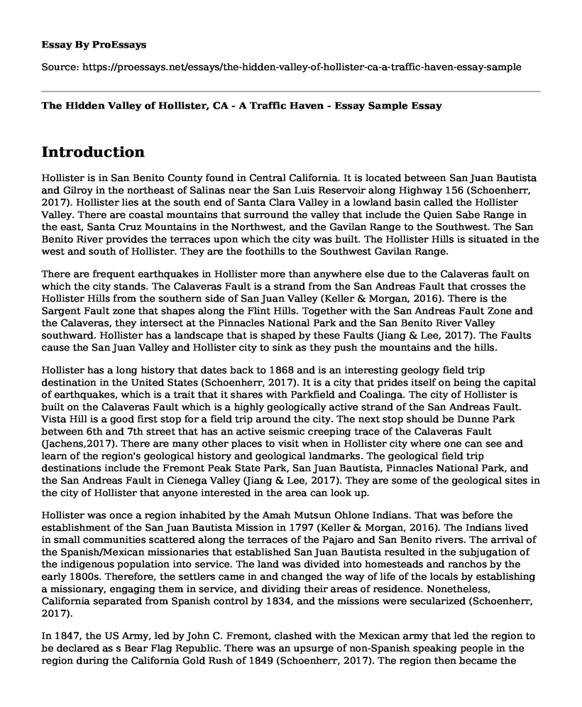
Image of Benitoite
The image shows the benitoite gem that is blue in color. It is one of the minerals found in Hollister, and thus a source of income in the region through mining (Jiang & Lee, 2017).
The Faults in Hollister such as the Quaternary fault are believed to have occurred 1.8 million years ago (Jachens, 2017). Modern historic times have witnessed the movements of the Calaveras Faults and the San Andreas Faults. The Faults are considered active, and some of them include the Sargent Fault, the Quien Sabe Fault, the Bear Valley Faults, and the Paicines Fault (Jiang & Lee, 2017).
Image of the San Andreas Fault
The image was taken by Stanley Skapinski in 1961 showing the Fault northwest across San Andreas Fault trace at the southern edge of DeRose Winery (Jiang & Lee, 2017). It is a common feature of the Hollister landscape as buildings and roads are constructed around it.
The Weather and climate have been contentious issues in recent years owing to the effects of global warming. There are those who have denied the concept and have criticized the idea as propaganda. Nonetheless, the results of global warming are evident for everyone to see its impact (Andrews, 2019). There are the recent forest fires in the Amazon and then in Australia. There have also been higher temperatures in the summer and lower temperatures in the winter. In addition, there has been an increase in sea levels owing to the melting of ice in the north pole. The reason for global warming is the increase in greenhouse emissions into the atmosphere propagated by industries and vehicles (Dykman & Escrivac-Bou, 2019). Recent years have seen an increase in the number of vehicles on the roads and industrialization in third world countries. The fuel emissions from vehicles add greenhouse gases in the atmosphere to dangerous levels. Congruently, the factories coming up in third world countries have also contributed to greenhouse emissions and the subsequent global warming. The entire world is responsible for the current predicament as was highlighted in the recent UN meeting (Andrews, 2019). As such it is everyone's responsibility to reduce pollution leading up to the extreme weather conditions.
California is a prime example of a region that has been adversely affected by adverse weather conditions. The region experienced two 3-year droughts within the last 2 decades (Dykman & Escrivac-Bou, 2019). There were record high temperatures during these periods, and they were followed by extreme wet winters. The combustible mix of the dry and hot conditions have led to severe fires across the California state. Therefore, California experiences extremely hot weather and then extreme wet weather conditions that pose a serious threat to both plant and human life. It is projected that the frequency between hot and dry weather conditions will increase in the near future due to global warming. People in the region have to contend with increased risk of wildfires, reduced snowpack, and increased temperatures (Andrews, 2019). In addition, there is still the risk of extreme droughts and extreme floods, with increasing transition rates.
California's redress the issue of climate change by going in the direction of implementing energy policies. The state has expanded its vehicle standards of pollution to cover greenhouse gas emissions and smog-forming pollutants. There are also policies that set standards for low-carbon fuel, integrating transportation investments and land use, and an increase in electric vehicles (Dykman & Escrivac-Bou, 2019). California identified the transportation sector as the major contributor to greenhouse emissions. The state has also enacted policies for businesses to trade emission permits through a cap-and-trade program. They have also integrated the land-use approaches to increase the amount of vegetation that absorb carbon dioxide from the atmosphere. There are concerted efforts from both the public and private sectors in California to reduce greenhouse gas emissions and to eventually reduce global warming (Andrews, 2019). They have witnessed first hand the extreme weather conditions and thus are a pioneering state in America to enact greenhouse laws.
References
Andrews, L. (2019). "Droughts, floods, fires and typhoons: Extreme weather caused by
climate change hit every continent in 2019 displacing millions of people and costing billions of dollars." Daily Mail. Retrieved from https://www.dailymail.co.uk/news/article-7828155/Extreme-weather-caused-climate-change-hit-continent-2019.html
Dykman, A., & Escrivac-Bou, A. (2019). "Californians Support Actions to Address Climate Change." Public Policy Institute of California. Retrieved from https://www.ppic.org/blog/californians-support-actions-to-address-climate-change/
Jachens, R.C., et al. (2017). The Evergreen basin and the role of the Silver Creek fault in the San Andreas fault system, San Francisco Bay region, California. Geosphere; 13 (2): 269-286.
Jiang, H., & Lee, C. A. (2017). Coupled magmatism-erosion in continental arcs: Reconstructing the history of the Cretaceous Peninsular Ranges batholith, southern California through detrital hornblende barometry in forearc sediments. Earth and Planetary Science Letters, 472, (15): 69-81.
Keller, S. M., & Morgan, M. L. (2016). Unfolding the geology of the West. Boulder, Colorado, USA The Geological Society of America.
Schoenherr, A. A. (2017). Natural history of California. University of California Press.
https://i1.wp.com/geologycafe.com/images/hollister_geomap.jpg
https://geologycafe.com/images/hollister_google.jpg
Cite this page
The Hidden Valley of Hollister, CA - A Traffic Haven - Essay Sample. (2023, Mar 27). Retrieved from https://proessays.net/essays/the-hidden-valley-of-hollister-ca-a-traffic-haven-essay-sample

so we do not vouch for their quality

If you are the original author of this essay and no longer wish to have it published on the ProEssays website, please click below to request its removal:
- Xarelto/Rivaroxaban
- Geography of the Alps Essay
- From Sea Land: South Africa's Great Karoo Essay
- Questions and Answers on Astronomy Tools
- Atomic Nuclear Decay and Uses of Radioactivity in Healthcare Paper Example
- Unveiling the Chemistry Connection: Physical Attraction & Social Interactions - Essay Sample
- Essay Example on East-Asian Realm: Monocentric or Polycentric?


